Back in 2014, almost 2 years before, I climbed Yushan (also called Jade Mountain, Chinese: 玉山; pinyin: Yùshān) with 5 other fellow hikers I'll call AJ, Patil, Katta, Swetali and Sagar. It was my 2nd overnight long trip in the high mountains of Taiwan.
Climbing Yushan is the most popular and “must do” experience in Taiwan for all hiking and trekking loving people around the globe. The Yushan National Park has a well-directed and maintained trails, maps, lodging, and a permit system to allow foreign hikers like us to have a great hiking experience on the way to the summit of the highest mountain in Southeast Asia. It is located within the Yushan National Park just next to the famous Alishan National Scenic Area in the central mountains of Taiwan. If measured from the nearby ocean floor, the Jade Mountain Main Peak rises an impressive 8,000m in only 100 km and from sea level it is just under 4000 meter. Yushan has 6 main peaks with the Main Peak being the most popular:
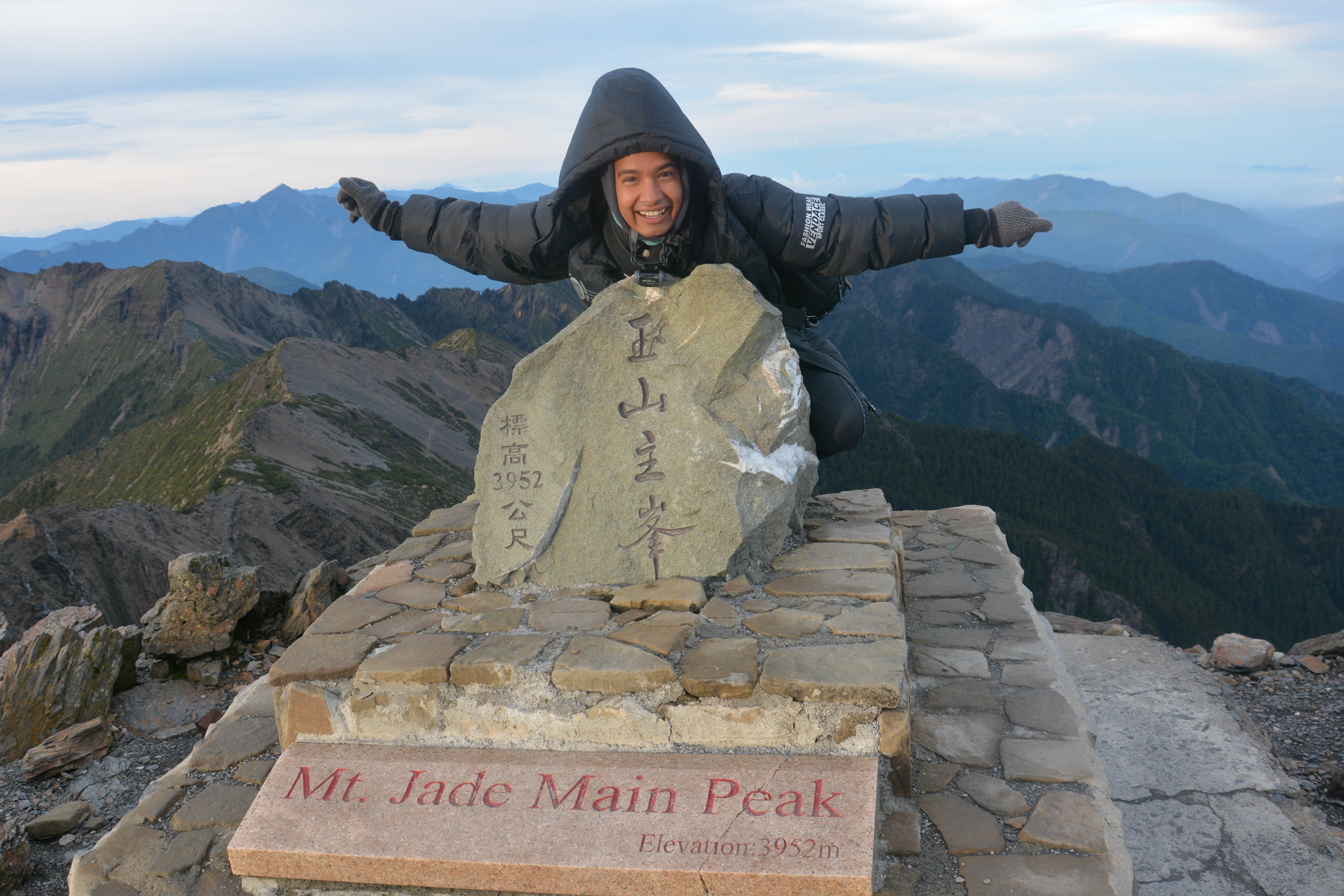
1. Main Peak: 3952 m
2. East Peak: 3853 m (4.5 km from Main Peak)
3. North Peak: 3833 m (3.5 km from "Wind Tunnel")
4. South Peak: 3711 m (3.1 km from just above Paiyun Hut)
5. West Peak: 3582 m (4 km from Paiyun Hut)
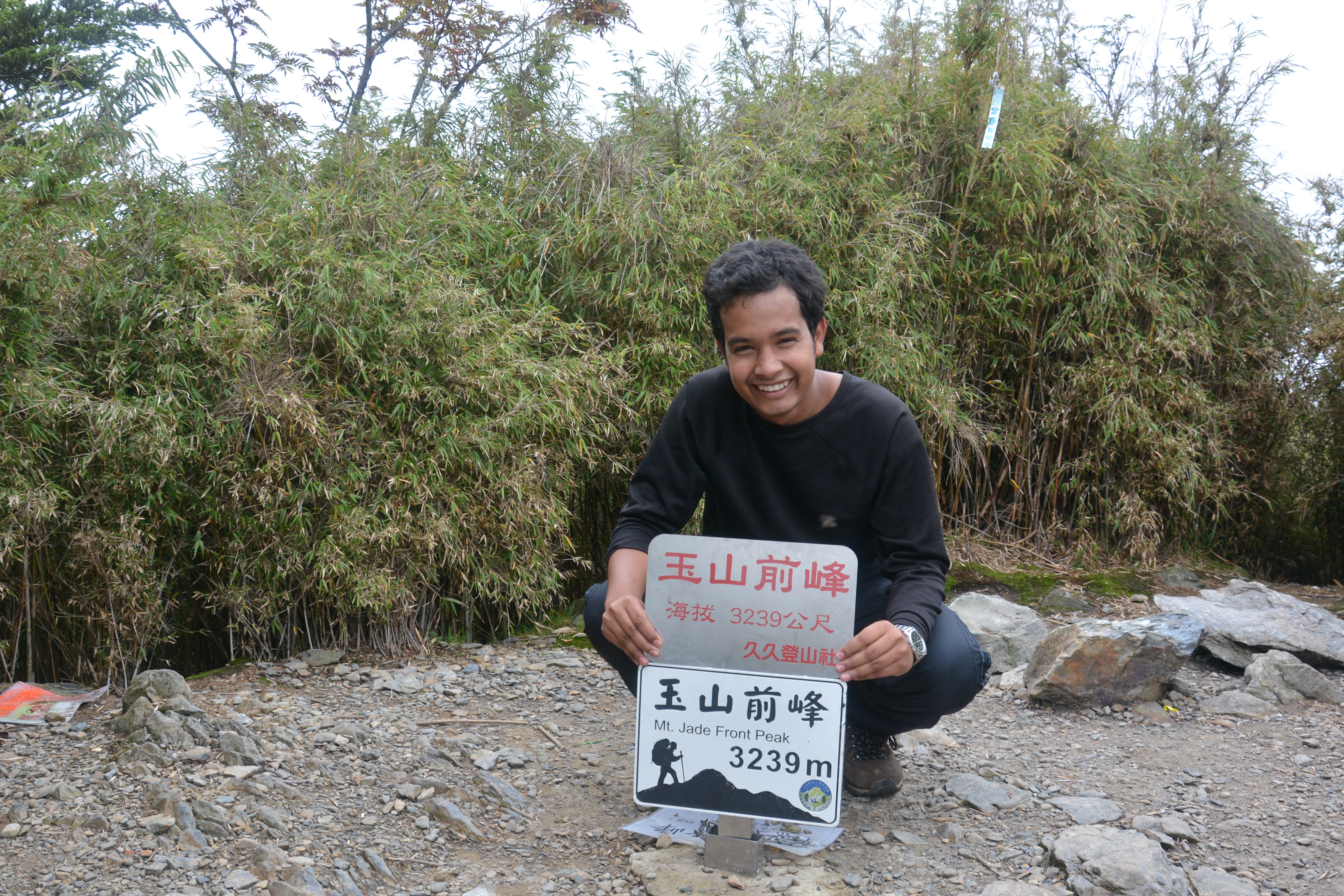
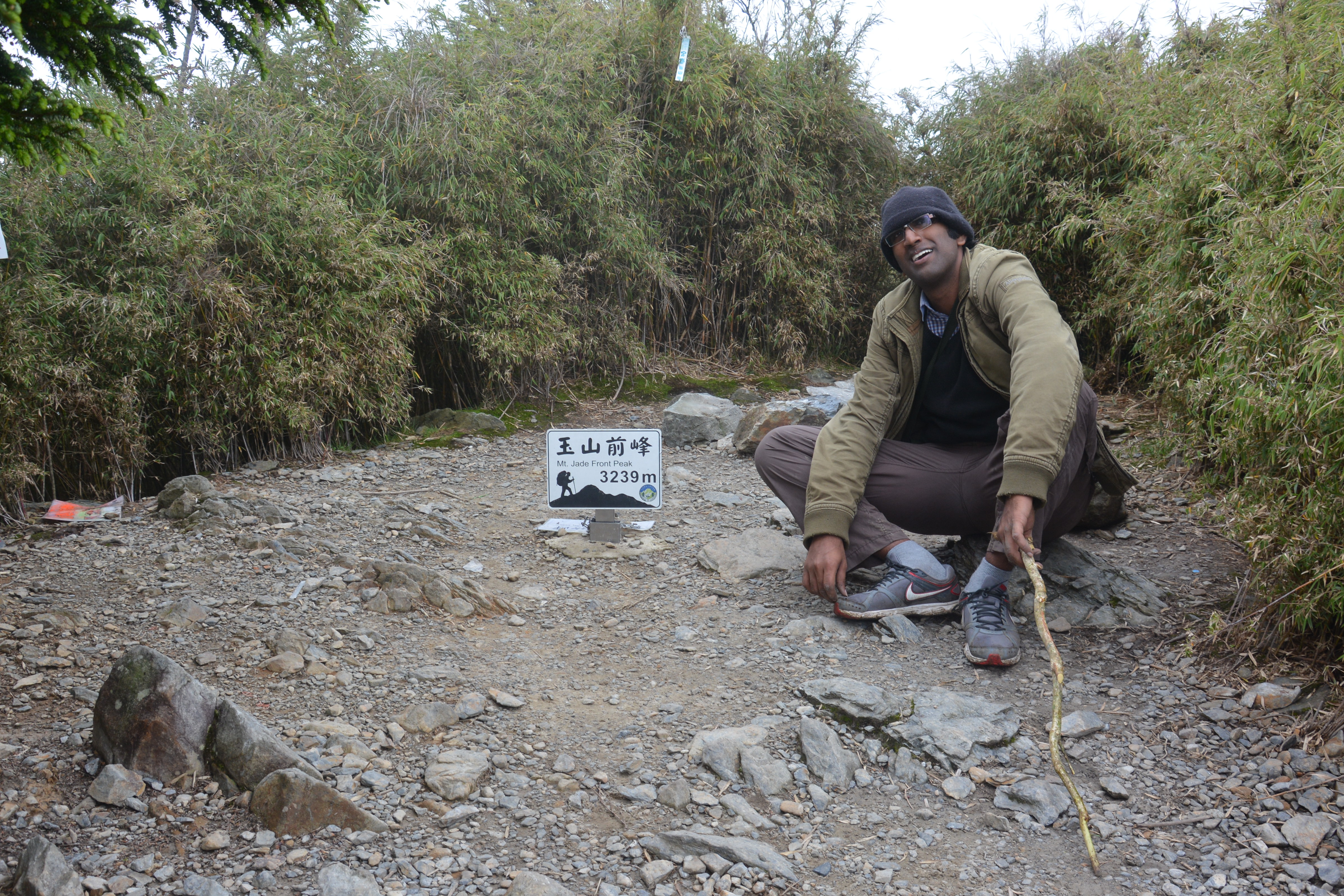
6. Front Peak: 3239 m (2.8 km from trailhead)
The hardest part of climbing Yushan is getting the permit in the first place especially for the weekend. Despite being the most popular, it is nearly impossible to get a permit for a weekend due to too many applications. For safety and environmental reasons, the trail is limited to a certain number of visitors each day. To deal with the excessive demand for hiking permits, the parks department holds a lottery several months in advance. Before applying for the permit, when I discussed with my Taiwanese colleagues about my climbing plan, they said they have applied 15-20 times and did not get it. Typically for a weekend permit, there are 2000 people competing for a mere 100 places, giving us a one in twenty chance. Saturday is the most popular day for permit demand. So, we changed our plan and applied for a permit to stay in the Paiyun Cabin on Sunday (instead of Saturday) night (June 1, 2014) and climb the summit on Monday June 2. We got the permit on our first attempt. All the credit goes to our beloved friend AJ for his lottery luck.
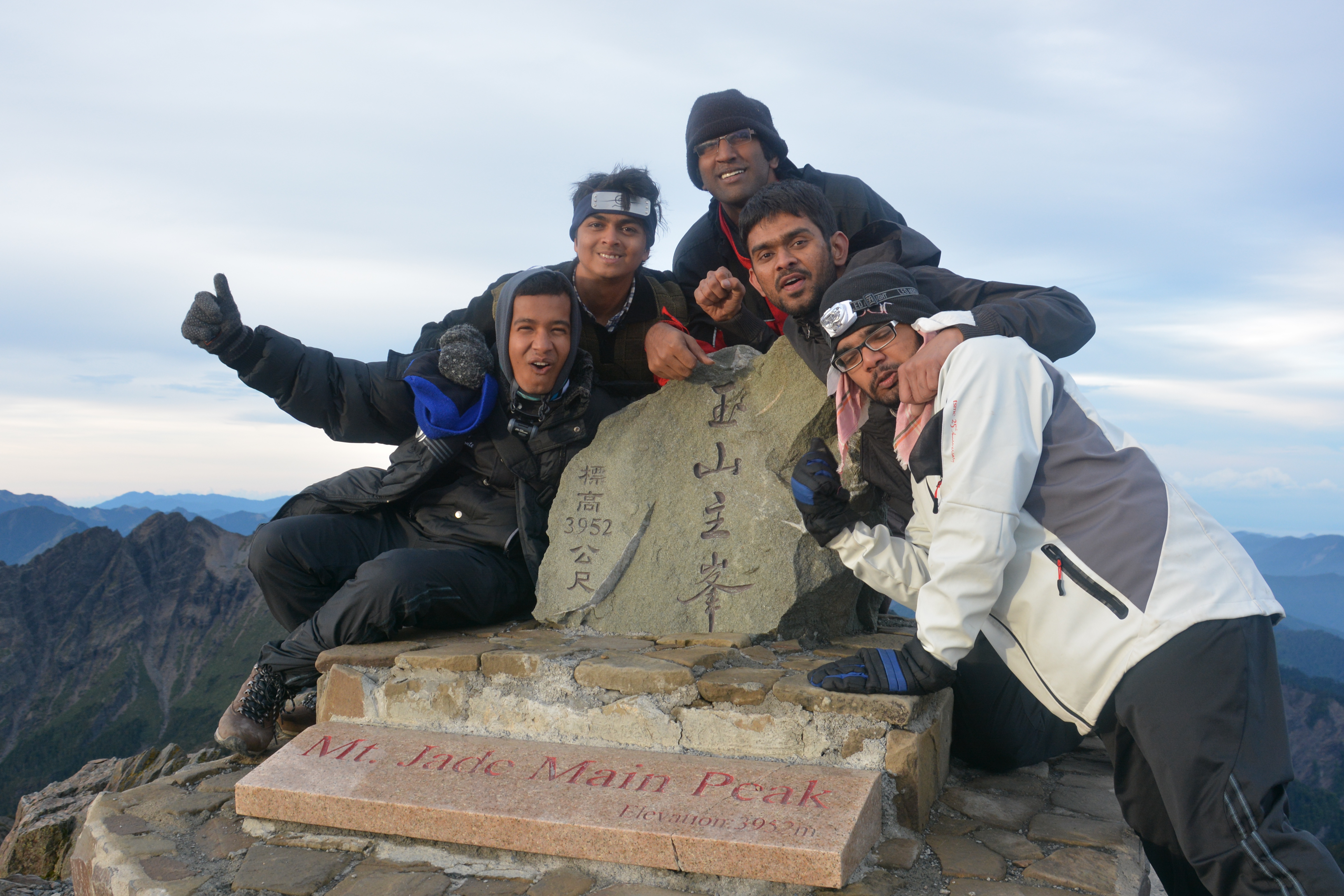
![The team [Swetali, Sagar, AJ, Patil, Katta, Me (L-R)]](http://www.samantavik.com/wp-content/uploads/2016/06/DSC_4345.jpg)
Day 1
8.5 km from Tatajia trailhead to Paiyun Lodge
We spent the night before the hiking in Alishan National Scenic Area. On next day early morning, we went to see the sunrise from the famous sun rising spot in Alishan. Then we drove to Yushan National park Tatajia office. It took around 45 minutes to reach there.
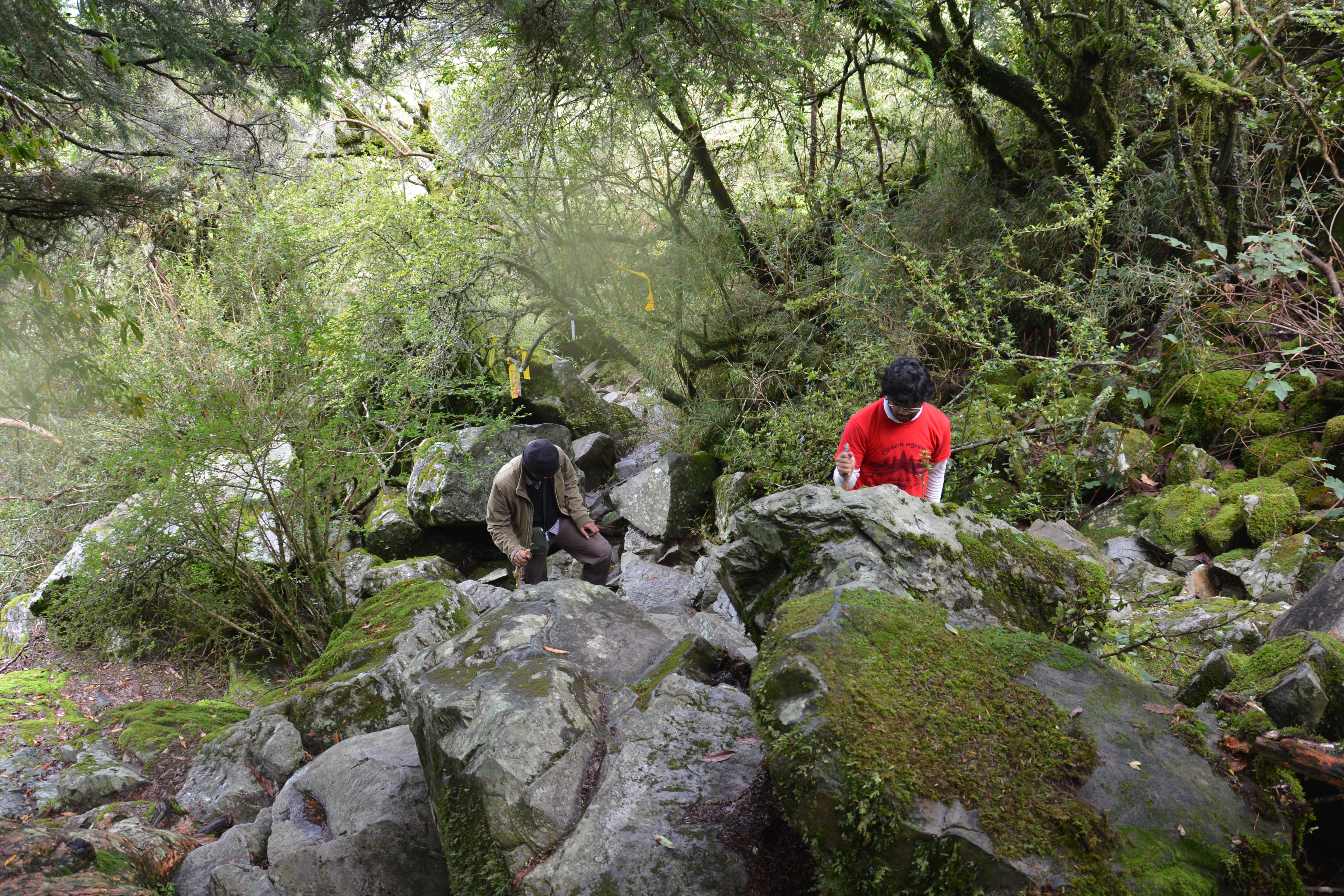
From the Tatajia Visitors Centre, it is a 2 km walk to the actual trailhead, but the park runs a shuttle bus service which costs 100NT person. But there is a short hiking trail through the forest. We took the hiking trail to reach the trailhead. At the trailhead, we took some customary group photo before get going.The weather forecast for the day was clear and sunny with a bit of passing rain around mid of the day. We started our hiking at 8:30 AM in the morning. The total distance from trailhead to Paiyun cabin is around 8.5 km. So, we had plenty of time to reach there before sunset. At 2.8 km mark there is a small trail going towards Yushan front peak. Total trail length was 0.8 km up and down with 400 meters elevation gain. It is quite stiff considering the trail length and elevation gain. After discussion, three of us (Me, Katta & Patil) decided to take our chances to go to the summit of that peak. Others went ahead with the main trail.After 0.4 km, the trail became rocky. There was no definitive trail direction, but there were many trail marker flags left by previous hiking groups.

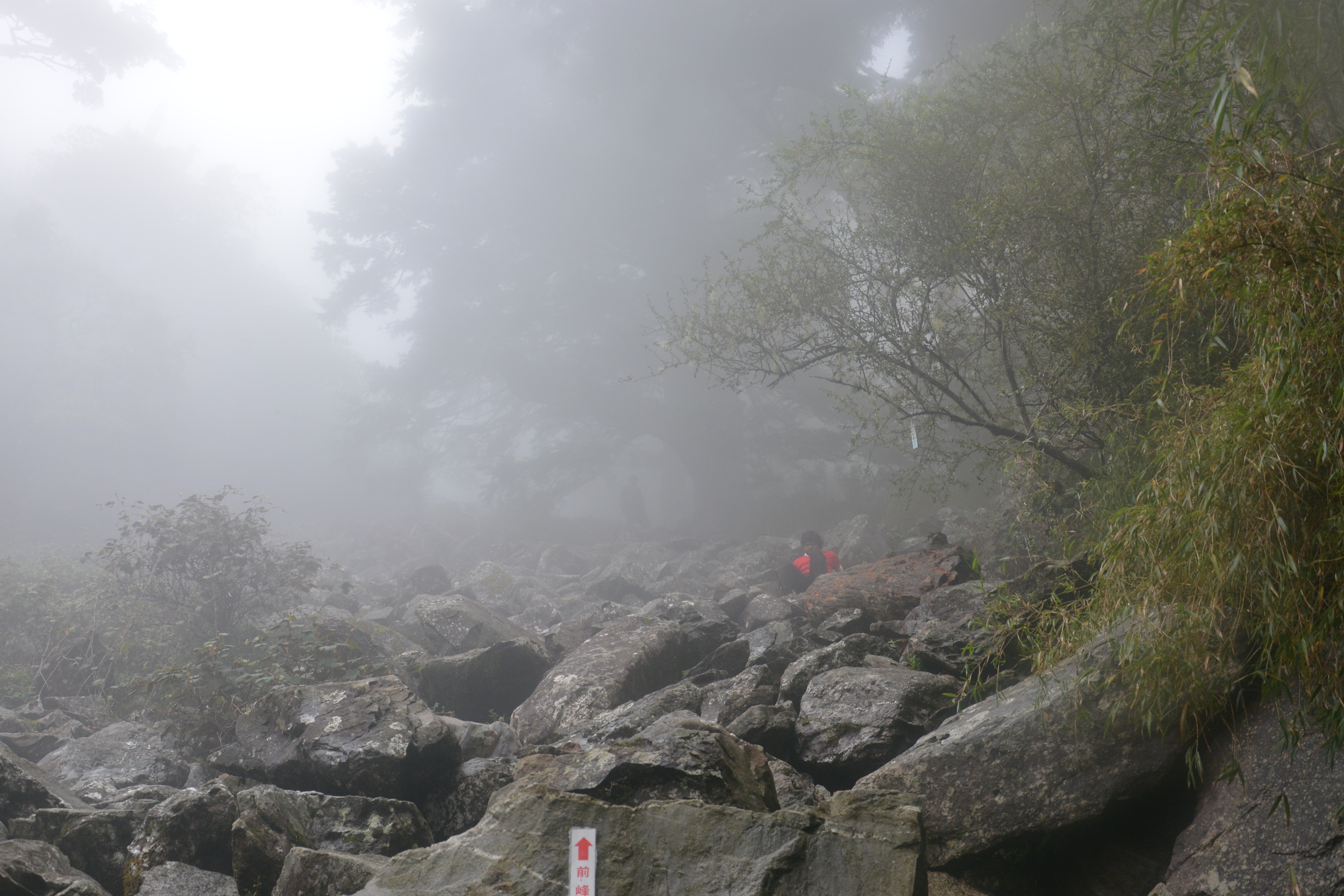
On the way, it started drizzling which made our journey to the summit very tough. About an hour and half of fighting with rain and loose rocks, we arrived at the summit of Jade Mountain Front Peak. It took 3 hours to complete the whole trek of 1.6 km what we initially thought to be a piece of cake.
After finishing the front peak trek, we headed back to the main trail. After taking some rest we headed towards Paiyun cabin. We reached there at 4 pm. Other members of our group already reached there and finished all the formalities with permit and everything. After having dinner at the cabin, we went to sleep early at 6:30 pm. The cabin was too crowded. There were 6-7 other groups in the same cabin.
Day 2
2.5 km from Paiyun cabin to Yushan main peak
11 km from main peak to the trail head.
Though there was lot of noise inside the cabin, I had a great sleep, but my fellow friends thought otherwise. Finally we wake up at 1:30 AM. It was a tough time to get up so early after the tough 1st day hike, but I was glad to get up for the night trek. It was very cold ouside. The mercury was already moving towards 0°C. We had some early breakfast and got ready for the final round towards the summit. 2nd day will be long as would be total 13.5 km hike.
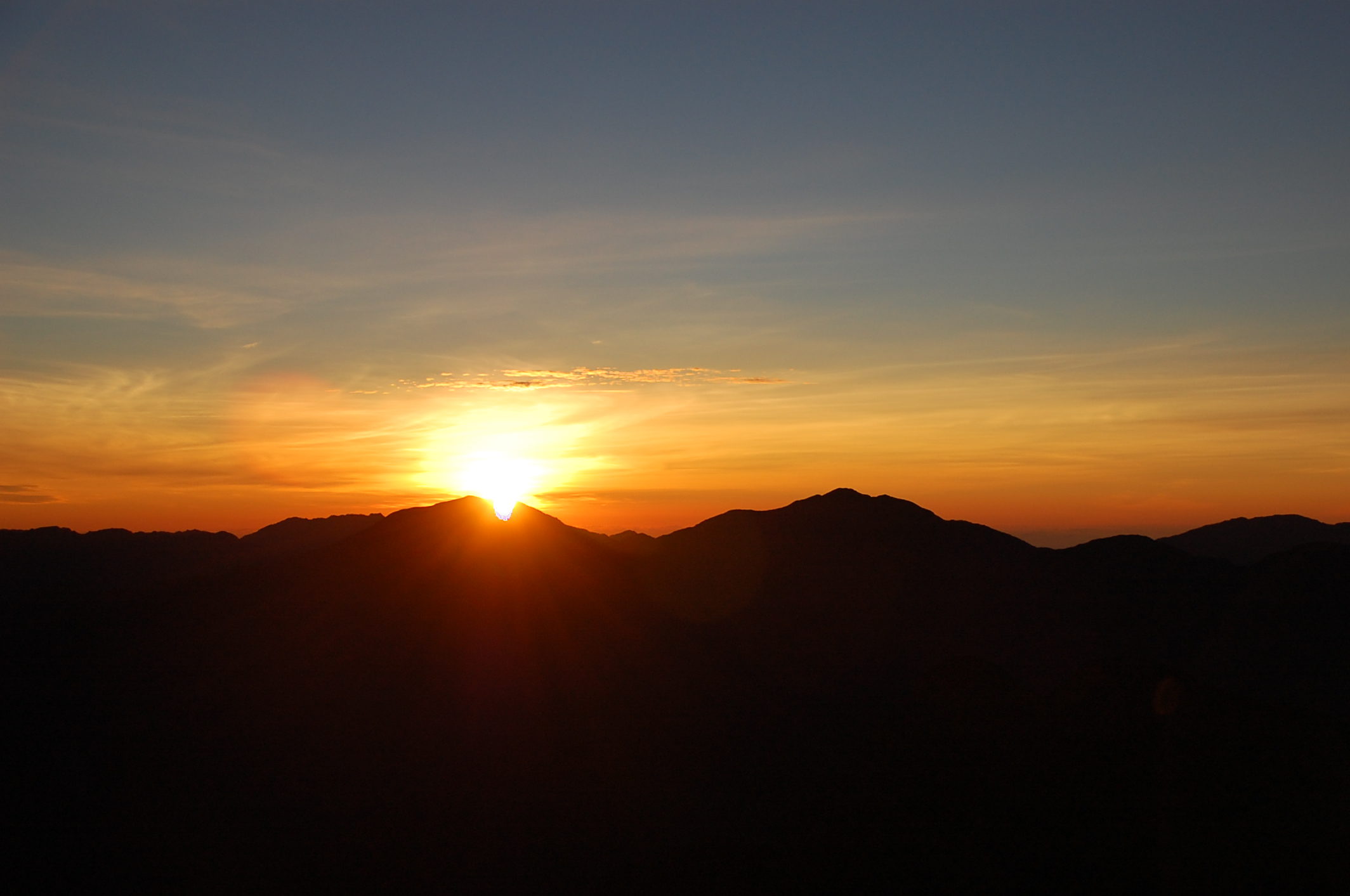
After a quick breakfast we, got our head torches on and hit the trail at 2 am. Outside ambiance was beautiful. It was a beautiful night sky with millions of stars. It was pitch dark around us and we could barely see anything beyond 2 miters with headlight on. AJ took the lead and me, Patil and Katta kept a distance. We wanted to go to the summit well ahead of the sunrise. Sagar and Swetali took it easy and stayed little behind.
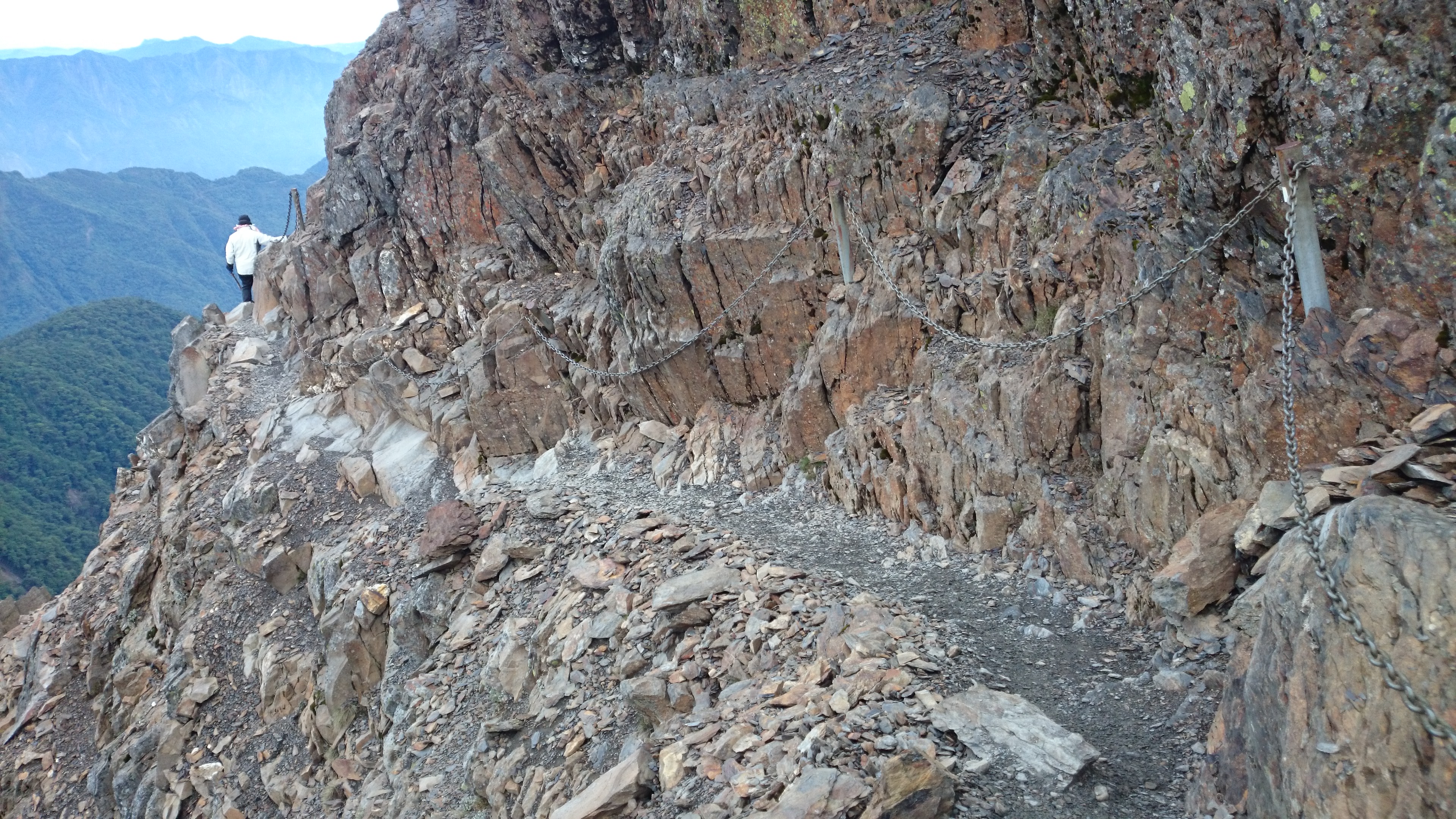
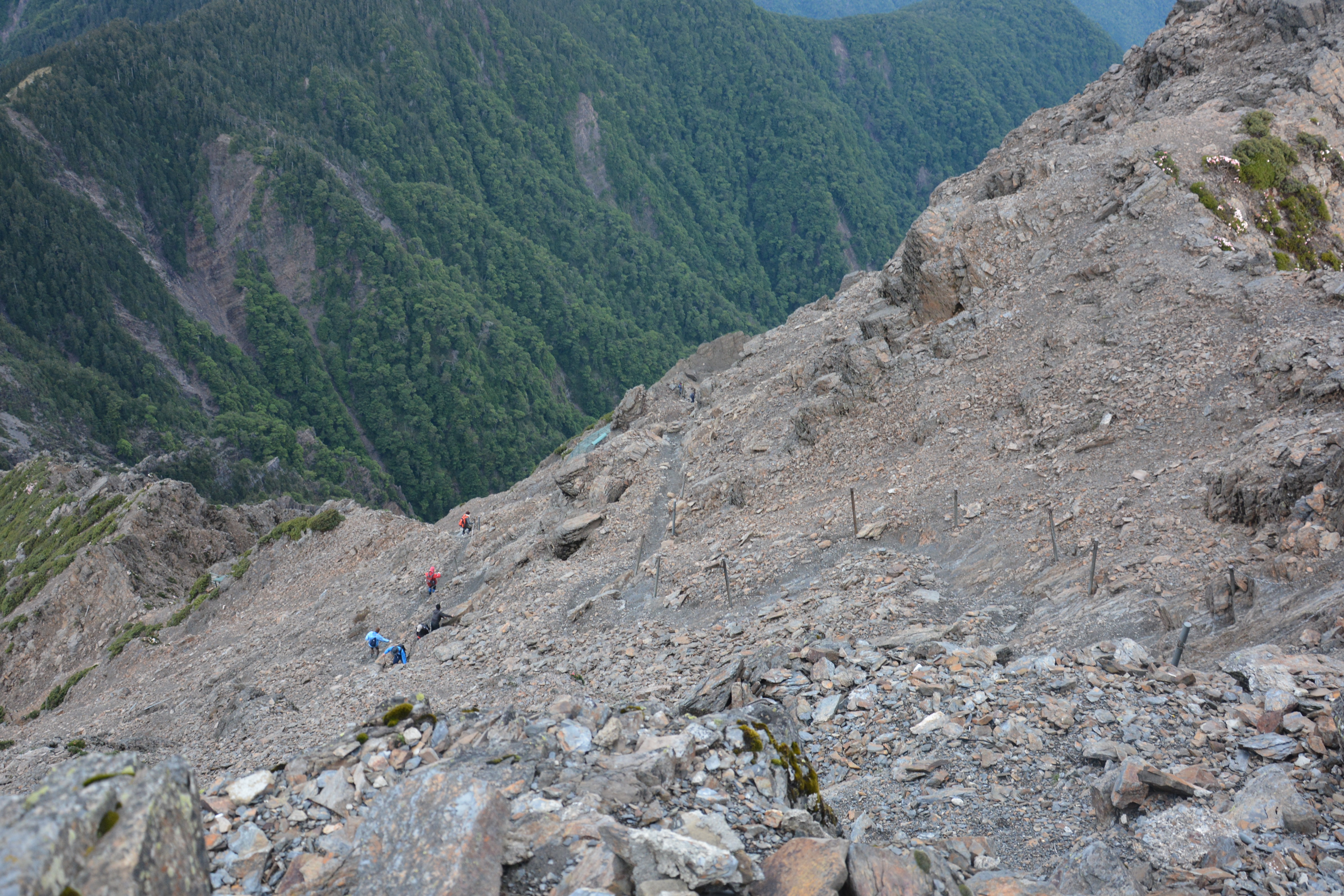
The beginning of the trail was zigzag upwards and quite easy going. The trail was well marked with sign boards. There were lots of trees around us. As we go up, the no. of trees fade away and there were nobody to protect us from strong wind. After 30-40 minutes of hike, it started to become harder and harder. At this point, It is easy to be lost from the main trail and it was very important to keep looking ahead to make sure that we were still following the main trial. There were many shortcut trails from the main trail. It is better not to take any shortcut route at this point as the rocks are very loose and accident could happen anytime.
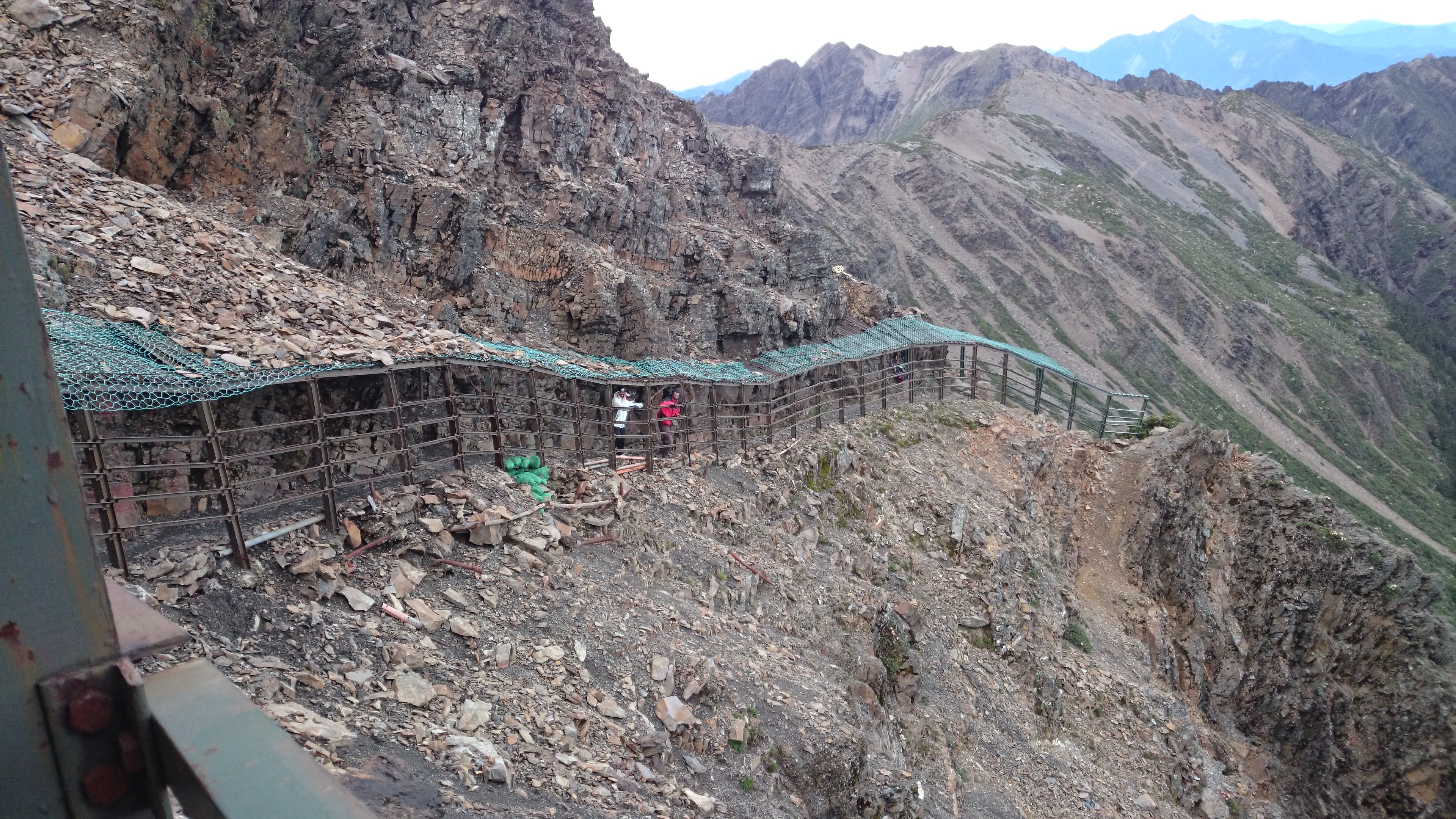
There was a tunnel built to protect the hikers from falling rocks. One should take attention to the low height of the beams inside the tunnel as it is easy to hit the forehead, as Katta could testify. The end of the tunnel was known as Fengkou. At this point, we could see the summit. We spend another 20-25 minutes to reach the top. It was 3:50 AM way to early considering the time of sunrise. We took zillion of pictures and hide behind the rocks to protect ourselves from strong wind. After another half an hour, we watched the beautiful Sunrise from the top.
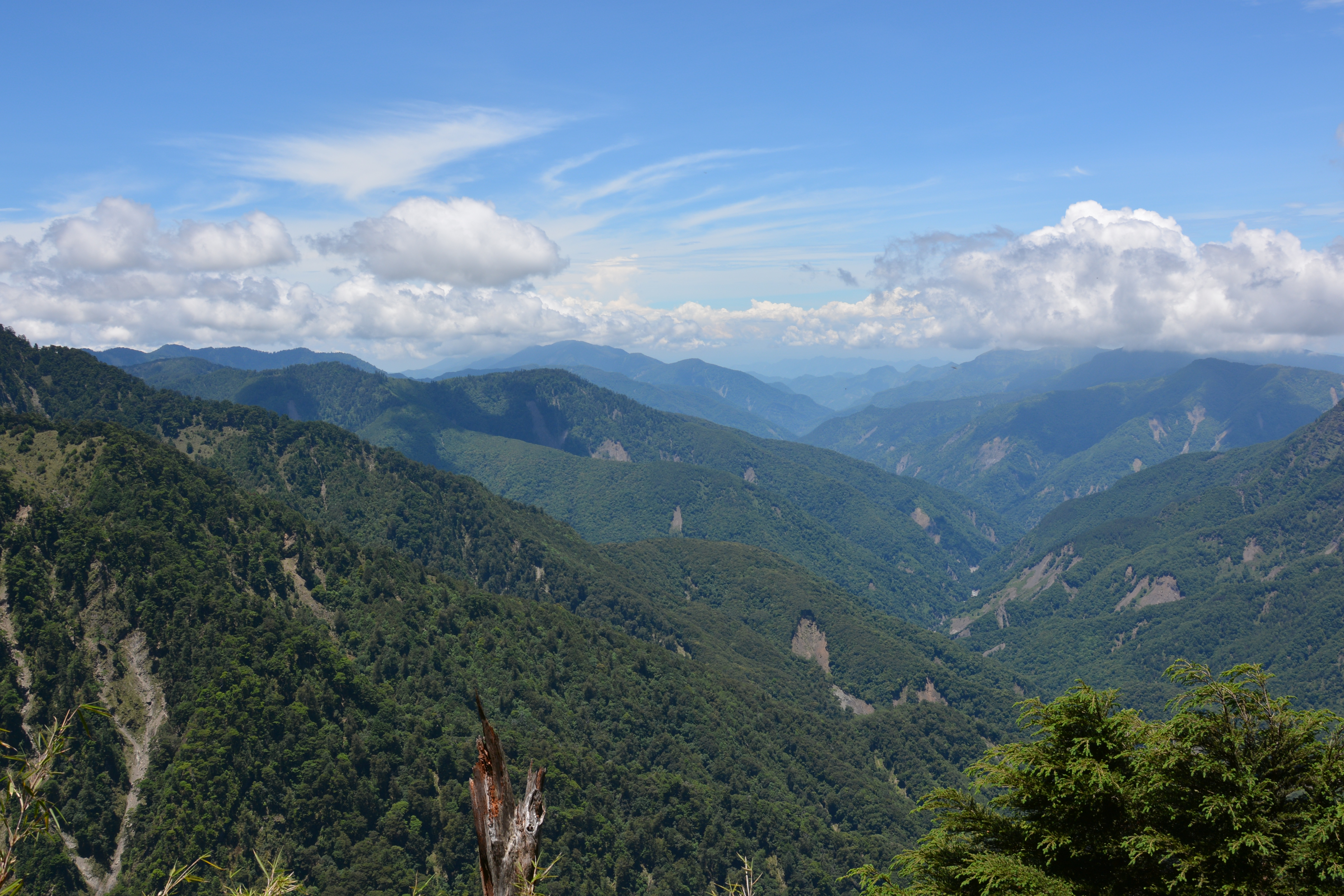
After waiting an hour at the summit, Sagar reached the peak. A Taiwanese fellow hiker helped us to take a group picture with the summit. Unfortunately, Swetali could not climb to the top as she twisted her ankle on the way. We started to move back towards trailhead immediately after the sunrise. On our way down we took some breathtaking images of the route we hiked in the dark. Swetali’s injury slowed us down a bit during return, but we reached the trailhead well ahead of our planned schedule.
Yo dada… 😀